History
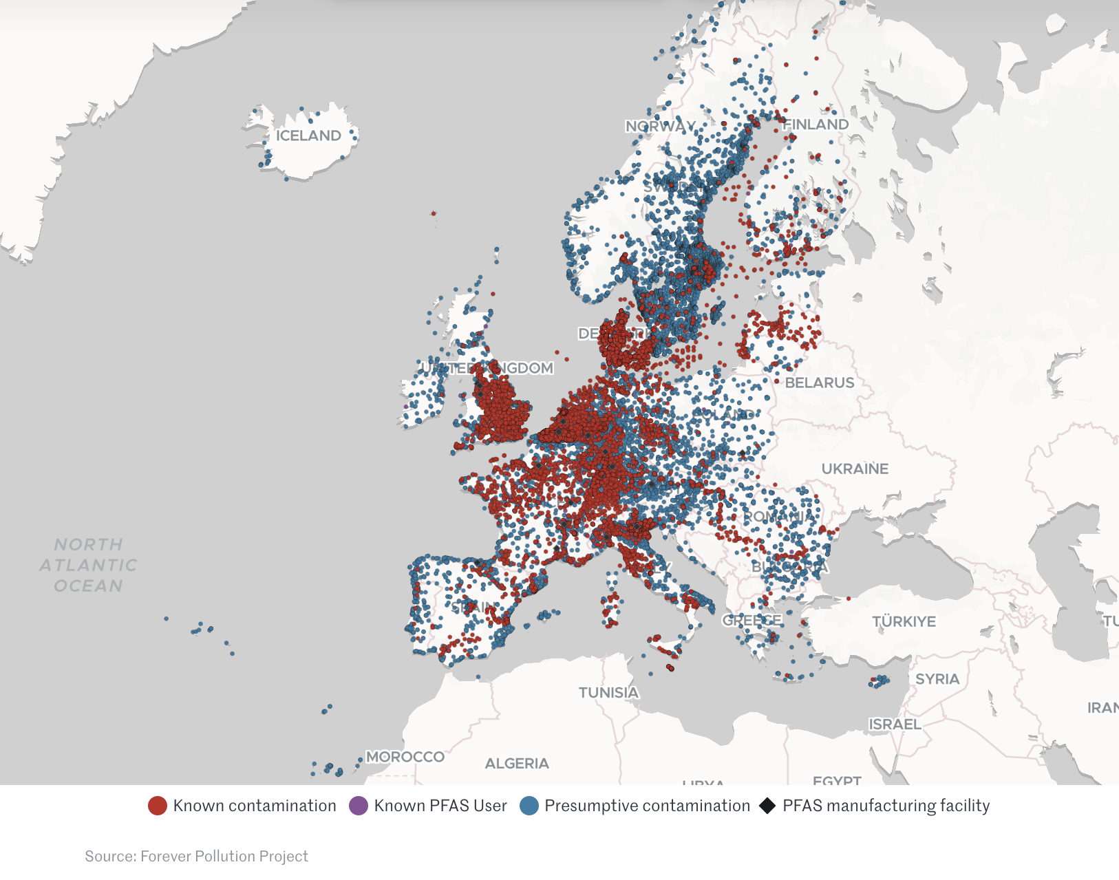
Early 2023, the Forever Pollution Project showed that nearly 23,000 sites all over Europe are contaminated by the “forever chemicals” PFAS. This unique collaborative cross-border and cross-field investigation by 16 European newsrooms revealed an additional 21,500 presumptive contamination sites due to current or past industrial activity. PFAS contamination spreads all over Europe, as shown on the map created by the project.
To establish this map, each newsroom in the project researched PFAS contamination data in their own area, resulting in over 100 data sources, that had to be standardised to be displayed on the map. The data was published at the same time than the map, as well as the methodology developed for the project (first published by Le Monde, then as a peer-reviewed article in Environmental Science & Technology) .

After publication, different research projects contacted us to re-use the data, and in January 2024 the PDH project was initiated by the CNRS. Its goals:
- To have a technical and operational solution so that the data keeps on being updated
- To make the data better:
- More complete (keep the values below detection limits, keep all individual PFAS substances concentrations)
- More robust from a methodology point of view (eliminating all manual operations)
- To have a website where the data would be accessible, both as a geo-visualisation, and as exports
- To be as collaborative as possible: that our data is the source of other projects, but also that other researchers indicate us available data that is not in our dataset yet.